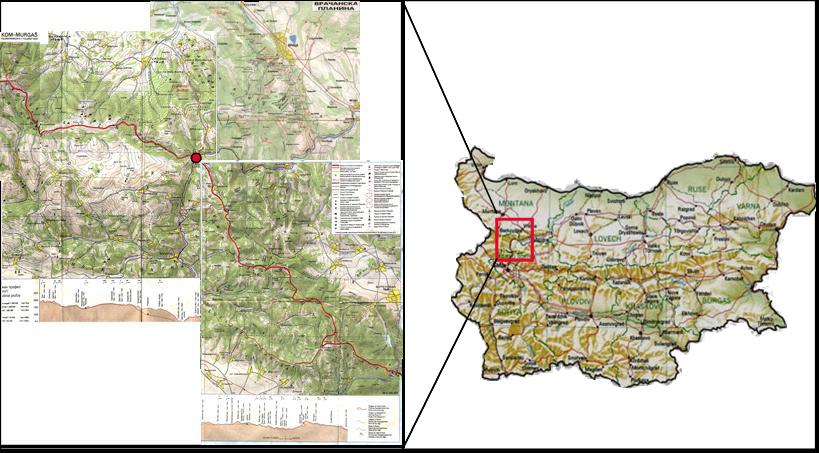
The Western part of the Stara Planina
Mountains is cut by the river Iskar on its way from the south (Sofia
basin) to the north (where it flows into the
Danube river). The Iskar
Gorge (near Lakatnik) is
surrounded by pictouresque karst rocks and caverns,
forming a protected natural area. At the Iskar Gorge the river
valley also
crosses the international long-distance walking route E-3 (red mark),
that starts in the Pyrenees and ends at
the
Black Sea coast. North of Lakatnik, between Iskar Gorge and the town of
Vraza extends
the mountain plain of Vratshanska
Planina (or Vratschanski
Balkan).
Vratshanska Planina
1 : 75000
Western Balkan (KOM -Lakatnik - International Mountain Route E-3) 1:100000
Western Balkan (Lakatnik - Murgas - International Mountain Route E-3)
1:100 000
Lakatnik Region of the Stara Planina (Hand-drawn map at the Railway station)
Nature Park "Vratschanski Balkan"
Back to Lakatnik